
Extreme heat exposes Toronto's uneven tree canopy divide as city plans for hotter future
Extreme heat exposes Toronto's uneven tree canopy divide as city plans for hotter future
City's goal is to increase Toronto's tree canopy to 40 per cent by 2050
What Toronto’s tree canopy map reveals about equity of shade access in the city
On a scorching summer day, you might notice walking down some Toronto streets feels a lot more comfortable than others.
The biggest difference is likely the number of trees.
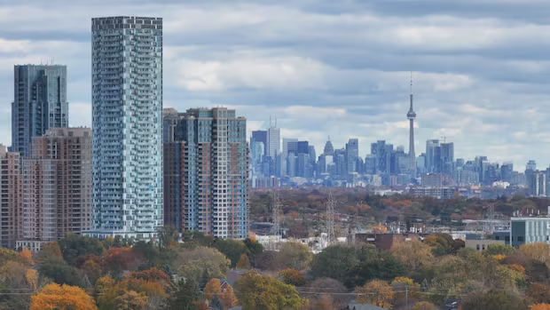
As the city faces another summer of extreme heat, where you live can make a big difference in how hot it feels as the city's tree canopy is not distributed equally.
"When you look at the tree canopy map and you overlay it with socioeconomic data, demographic data and income levels, you'll realize many wealthier neighbourhoods have better access to shade. While lower-income neighbourhoods have less access to tree canopy," explains Dorsa Jalalian, an associate and senior urban designer at DIALOG, an architecture and design firm in Toronto.
This time next year there could be a maximum heat bylaw for Toronto rentals
Experts have projected that by 2080, southern Ontario including Toronto will experience 55-60 days per year where the temperatures exceed 30 C, compared to an average of 14 days per year, according to a city of Toronto climate report.
Meanwhile, the city, architects, urban designers and planners are looking at ways to close the gap in neighbourhoods with the least shade.
"When we think about climate change and how we adapt to that new climate, we have to think about shade as public infrastructure and essential infrastructure," Jalalian said.
Neighbourhoods with a higher concentration of condos and apartments are susceptible to the "urban heat island effect" a well-known phenomenon that has been studied in Canada and around the world, according to Jalalian.
She explains that built up neighbourhoods tend to trap and radiate heat, making them several degrees warmer than the surrounding rural areas or neighbourhoods with more trees, resulting in the urban heat island effect.
City's goal is to increase tree canopy to 40% by 2050
Toronto's tree canopy currently covers approximately 30 per cent of the city. The goal is to increase that to 40 per cent by 2050, says James Nowlan, executive director of the city's environment, climate and forestry division.
But building up the tree canopy is just one part of the solution. Historical growth patterns mean the trees themselves aren't equally spread across the city, he says.
"What we've been doing is looking across the city and saying okay, where do we have trees, where do we need trees and how are people accessing those trees," says Nowlan.
Toronto looks to expand tree canopy with planting on private land
Nowlan says city is planting around 120,000 trees per year and prioritizing the areas that need them most.
It's also working with American Forests, a non-profit conservation organization, and LEAF, an organization dedicated to nurturing urban forests, which together have come up with a free online interactive tool for the public, called the Tree Equity Score Analyzer for Toronto.
The tool allows to see tree equity scores in neighbourhoods across the city, ranging from zero to 100. For example, Beach and Baby Point have scores of 100. Downsview has a score of 57 and New Toronto has a score of 56, making them "highest priority" for further planting.
In 2025 the city, in partnership with DIALOG, developed what they call thermal comfort guidelines. According to the city, the guidelines are the first comprehensive, four-season outdoor thermal framework in North America to evaluate public spaces using wind, humidity, air temperature, and radiant temperature.
"That essentially looks at how urban design, urban planning and landscape architecture can work together to improve thermal comfort throughout the city," said Jalalian.
"I think its a big step in shifting how we think about thermal comfort in our city because historically Toronto thought of itself as a winter city."
Transit routes should be studied, expert says
But even though new trees are being planted, they take years to grow, says Nidhi Subramanyam, assistant professor of geography and planning at the University of Toronto.
Meanwhile, rising temperatures affect our lives in many ways, including how we move around.
"I think we need to do a good assessment of our different transit routes and stops to see where they are in terms of thermal comfort, and to understand where we might put in passive cooling," she said.
"We need to make transit shelters or bus stops now that can be places of refuge."
The university's heat vulnerability map exposes some priority areas, such as Scarborough Centre and Etobicoke North.
"It shows that heat exposure tends to be correlated with income and in communities where there is a higher concentration of immigrants in our city," she says. "These communities tend to be really vulnerable to extreme heat stress."
Toronto is designed for a climate that doesn't exist anymore and it needs to 'face the reality,' experts say
Subramanyam would also like to see the city make more efforts to ensure new immigrants are aware of the resources available in addition to the city's cool spaces map.
The city says residents are encouraged to to call 311 if they're interested in learning more about planting a tree on their property.
Talia Ricci is a TV, radio and web reporter at CBC Toronto. She enjoys covering offbeat human interest stories and exposing social justice issues. Talia has also reported in London, Ont. and Winnipeg, Man. You can email story ideas to talia.ricci@cbc.ca.
Related Stories
 Canada
Alberta separation threatening 150 years of Treaty 6
3 hours ago
 Canada
Sextortion and online safety awareness
3 hours ago
 Canada
Kim Mounts Sunday Charge in Canada, Finishes Solo Third
3 hours ago
 Canada
'It won't be easy': Premier Scott Moe braces for tariff impacts to Saskatchewan
3 hours ago
 Canada
‘We’re in this for a while’: Canada
3 hours ago
 Canada
He was waiting for his son to return from the USS Lincoln. Then Border Patrol arrested him.
4 hours ago
 Canada
What major media outlets are saying about the trade war
4 hours ago
 Canada
Bandit crowned Canada’s top player for a 2nd time
4 hours ago