
Museum releases historical photos of island where Amelia Earhart may have crashed
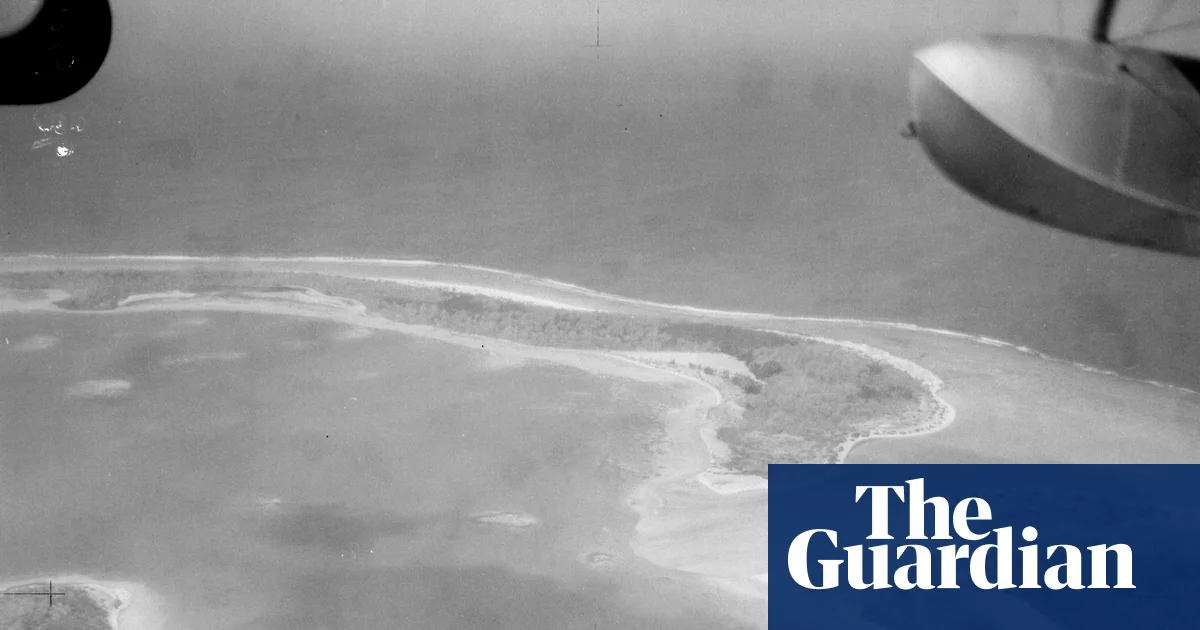
A New Zealand museum has released nearly 50 photos from a 1938 aerial survey of the island where Amelia Earhart is believed to have crash-landed, offering amateur sleuths new evidence to scour for traces of the pioneering aviator and her plane.
The black-and-white images were published by the Air Force Museum of New Zealand after renewed interest in one of the biggest mysteries of the 20th century, spurred by a US expedition to the Pacific atoll of Nikumaroro in search of new clues.
While some low-resolution copies have been uploaded on blogs, the Air Force Museum of New Zealand said it had received several requests for the photos and had released the full set of 47 images in digital high-resolution format on its website.
The negatives were found more than a decade ago by Matthew O’Sullivan, the keeper of photographs at the museum in Christchurch.
Earhart’s most prominent investigator, Ric Gillespie, described the images as a “goldmine” in his blog, saying they were a complete set of aerial photos taken on 1 December 1938 by an amphibious biplane during a New Zealand survey of Pacific islands that was looking for suitable airbase locations.
What happened to Earhart and her navigator Fred Noonan when they disappeared on 2 July 1937 during an attempt to circumnavigate the globe at the equator has been a stop-and-start search over eight decades, filled with false leads.
A leading theory is that the aviator, who broke several records including becoming the first woman to fly a nonstop solo trip across the Atlantic, ran out of fuel and was marooned on Nikumaroro, then known as Gardner Island.
The hypothesis is that she survived for a while, drinking rainwater and eating fish and turtles, based on signs of a castaway’s campsite and artefacts, including glass from a jar that is thought to have contained cosmetic cream.
This week, archaeologists and scientists from Earhart’s former benefactor, Purdue University in Indianapolis, are searching a part of the island for the “Taraia Object”, an elongated shape in a lagoon named after the part of the island where it was first noticed in a 2020 satellite image. Other longtime Earhart explorers, including Gillespie, are not convinced, saying it is probably a fallen tree and not the wreckage of her Lockheed Model 10-E Electra. The small atoll has been visited dozens of times.
In their latest update on Nikumaroro, which is part of the archipelago country of Kiribati, the expedition said severe weather had hampered their metal-detecting but that they would release an update within 48 hours.
“Despite Thursday’s weather delay, the expedition remains on schedule, with two more days of field operations planned – and an update on the identification of the Taraia Object expected,” Purdue University said.
Rick Pettigrew, the expedition lead and executive director of the Archaeological Legacy Institute, said: “We understand the tremendous interest in what we’re doing at Nikumaroro, and we appreciate everyone’s patience. This is a complex scientific process. You don’t simply arrive at a site and immediately identify what’s there. We have to carefully collect the data, analyse it and reach sound conclusions.”
The New Zealand military images are some of the earliest photographic evidence of the island. There is no immediate sign of an object in the Taraia area.
Related Stories
 World
World
Manolo Morettini targets 6DAYS® gold in the Club Team Award
47 minutes ago
 World
World
The World of Motorcycling- News detail
47 minutes ago
 World
World
World Food Day: UNICEF warns of climate threat to child nutrition
1 hour ago
 World
World
Under US pressure, World Bank says it will back gas “where appropriate”
1 hour ago
 World
World
Istanbul's worst floods in 80 years leave 4 dead
1 hour ago
 World
World
Video. Latest news bulletin | October 16th, 2026
1 hour ago
 World
World
Brewers sweep Dodgers to reach World Series for first time since 1982
3 hours ago
 World
World
Russia strikes 9 Ukrainian regions as strain grows between Zelenskyy and Trump
3 hours ago